VENEZUELA IN THE WORLD
Venezuela is located in the American continent, to the north
of America of the South. It is the only South American
country that possesses coasts open to the sea Caribbean and to
the ocean Atlantic, with an extension of costs that goes
from Castilletes to the promontory of it Gave birth to
in the sea Caribbean. With the ocean Atlantic extends from the
promontory of it Gave birth to until the coast of the
Guayana Esequiba. This position locates it in an axis
of communications among different points of the continent,
being connected to the big commercial nets thanks to its
equidistancia with the main centers of the western
hemisphere, so much of America of the North, as of Europe and
África. Venezuela is, to oneself time, a Caribbean,
Atlantic, Andean and amazon country.
The country has a surface of 916.445 km². These extensive
territories are expressed in a compact continental surface
whose maximum longitude is of 1.493 km in address this-west
and of 1.271 km in address north-south, what contributes to
facilitate the integration and internal cohesion. It has a
wide coast line that reaches in the sea Caribbean the 2.813
kms of longitude from Castilletes to the promontory of it Gave
birth to (sees you Peninsula of it Gave birth to); their form
is irregular and it is constituted by numerous gulves and
bays, among those that highlight the gulf of Venezuela and
those of Sad and Cariaco, and more than 314 islands, keys and
islands of Venezuelan sovereignty that extend for the north
until the island of Ave and its corresponding area of marine
economic exclusivity. In turn, it has 1.008 km of continental
riversides in the ocean Atlantic, from the promontory of it
Gave birth to tip Beach, including the gulf of it Gave birth
to, the island of Ducks and the coast facade of the delta of
the Orinoco and adjacent islands, where they highlight the
drops wild, muddy cost and covered with swamps.
Venezuela, name
of
Appears for the first time, written Veneçuela, in the map
that the Spanish cartographer Juan of the Thing drew in
1500 when returning of the trip that, under the orders of
Alonso of Ojeda, he had carried out in 1499 along the
costs of the current Republic of Venezuela. In this map
that name designates the area of the gulf of Venezuela,
located among the
peninsulas of Paraguaná and of the Peasant. Traditionally the
paternity of that name has been come attributing to the
Italian navigator Américo Vespucio who also participated
in the exploration of Ojeda; however, it should be kept
in mind that in its letter of The four sailings, printed
in Latin, by Martín Waldseemüller in 1507, Vespucci compares
the
populations indigenous palafíticas with Venice («…pagum
aut villam super aquas, ut Venetiae…») but it doesn't
use the word Venezuela neither the expression «small
Venice».
On the other hand, in a declaration given in 1512, Ojeda says
that after the admiral Christopher Columbus was him who
traveled and he discovered the coast «…hasta the gulf
of the Pearls… and of there it was discovering that entire
coast of the mainland from the Friars until in even of
the islands of the Giants and the gulf of Venice that is in
the
mainland and the county of Coquivacoa…» it is certain that
the view of one or several towns built natives on the
water by means of platforms sustained by stakes (palafitos)
he suggested Ojeda, the Thing and Vespucci the
comparison with Venice. However, the use of the
affective diminutive «Venezuela» (derived evidently of the
name of the Italian city) it must award with more
property to Juan of the Thing who included it in their map, or
to the
boss of the expedition, Ojeda, without this excludes the
possible participation of Vespucci.
In 1528, in the capitulation in which emperor Carlos V gave
the Welser the exploitation of the lands that you/they
are included between the End of the Candle and Maracapana,
is spoken of «…las lands of Venezuela and his
Counties…» so that Ambrosio Alfínger arrived to
Choir in 1529 as the first governor from Venezuela. The name
of Venezuela had papal consecration in a bull of
Clemente VII of June 21 1531 in which believes the
Bishopric of Choir. During the XVI and XVII centuries it is
used Government of Venezuela or county of Venezuela
indistinctly to refer to the territory of variable limits
that was adjacent with the county from New Andalusia to
the east and it reached for the occident until the End of
The Candle
TERRITORY
AND RESOURCES
In
the Venezuelan territory they combine the imposing reliefs of
the mountain range of you Walk them, the mountain range of the
Costa and the solid one Guianese, with the formations of half
altitude of the system Coriano and the depressions of the
states of Yaracuy and Lara, where the cities of Barquisimeto
and Carora are; also, the topography of the low lands of the
basin of the lake of Maracaibo is also recognized, of The
Plains, in the system of the delta of the Orinoco, and of the
plain of the river Casiquiare in the Venezuelan Amazons.
In
the occident of the country they are the mountainous lands of
you Walk them Venezuelans that are divided in the mountain
range of Perijá, with their maximum altitude in the pick
Tutari (3.750 m) located in the mountain of the Motilones, and
in the mountain range of Merida, where the highest point in
the country, the pick Bolivar is located (5.007 m) in the
mountain Nevada of Merida. In the north is distinguished other
important mountainous group, the mountain range of the Costa,
divided in serranía of the Central Coast whose maximum
altitude constitutes it the pick Naiguatá (2.765 m), and
serranía of the Interior, with its maximum altitude in the
pick Turimiquire (2.596 m) in the east of the same one (sees
you Sierra of Brig). Near to the coast of the sea Caribbean
the low lands of the depression of Maracaibo are located,
where is the lake of Maracaibo, an extension toward the
interior of the gulf of Venezuela.
They
have singular importance the formations of low lands of The
Plains, where is distinguished between The high Plains and The
low Plains, separated by the curve of level of the 100 meters.
The high Plains are not susceptible of flood and they present
waves originated by the fluvial erosion; they reach their
maximum altitudes in the llanero-Andean piedemonte, where
floors of great fertility are recognized. The low Plains are
conformed by alluvial plains that are flooded in the rainy
season, converging their net hidrográfica with the system of
the river Orinoco; their vegetation is of tropical pastizales
of savanna.
The
formations of the shield or solid Guianese are separated from
the rest of the country for the wide arch of the river Orinoco
and they are prolonged for the Venezuelan Amazonia in the
imposing mountains of Parima and Pacaraima, with numerous
tepuy (it names local that mentions to plateaus tabulares)
located next to the frontier with Brazil. In their
northeastern end they highlight the deltaic low lands of the
Orinoco. In turn, between the riversides of the Orinoco and
the 6° latitude N, the Guianese landscape is manifested in
plains with altitudes that oscillate between the 200 and the
500 m, dominating the climate llanero and the savanna
formations. To the south of this parallel one big tepuys
prevails, among those that the Auyan Tepuy highlights (2.450
m) that harbors the Jump Ángel, in the river Churún, flowing
of the Carrao, a spectacular cascade of 979 m, the highest in
the world. Here they dominate the wild formations.
Location
North of America of the South.
Limits
North: Territorial seas of Republic Of the Dominican Republic,
The Antilles, Puerto Rico and Virgin Islands,
Martinique, Guadalupe, and Trinidad and Tobago. South:
Brazil and Colombia. This: Ocean Atlantic and
Guyana.
West: Colombia.
Coordinated
North latitude: Among the parallel ones 0°38´53´´, in the
birth of the river Arari (state Amazons) and the
12°11´46´´ in the end of San Román (state Falcon), more
northern point of the continental part of the country.
The Island of Ave is a key factor in the extension of
the limits of territorial waters.
Latitude west: Among the meridians 58°10´00´´, point
located in the oriental end of the river Esequibo, in
the Guayana Esequiba (Area in reclamation) and the
73°25´00´´, in the birth of the Intermediate river
(state Zulia). Their insular territories extend northernly
to Island from Ave to 15°40´33´´.
Surface
916 667 km2.
Extension of coasts
4 006 km.
Total population
22 105 265 inhabitants The
current Venezuelan population is product of a strong
miscegenation begun in the times of the colony between the
indigenous population and the Spaniard; later on, at the end
of the XVI century, an important contribution of population
slave coming from the African continent was observed. With the
step of the time increased the miscegenation process
characterized by the free union", accepted as institution
in the country. At the end of the decade of 1940, with the
beginning of the industrialization process, an important
immigration of Spanish, Italian and Portuguese origin began
that was increasing up to 1958. In the decade of 1970 took
place this same process but played by citizens of South
American origin, due to the development of the Venezuelan
economy and to the deterioration and economic recession of
their origin countries. At the present time all these
migrations have given origin to a population totally
integrated to each other, where any type of conflict
interracial doesn't exist.
The
population from Venezuela (according to estimates for 2002) it
belonged to 24.287.670 inhabitants, with a density of 27
hab/km². however, the distribution is not balanced: more than
the population's 80% groups in the coasts, valleys and
piedemontes of the mountain range of the Costa and the one of
you Walk them, being created this way big populational holes
to the south of the fluvial axis Orinoco-hurries. It is
necessary to point out that more than the population's 40% it
is seated in the eight more important urban complexes of the
country. In the south of Venezuela and partly of the region
zuliana most of the indigenous population is located that
grieve it reaches 1,5% of the national total. The population's
13% lives in rural areas.
Administrative
divisions
Division territorial politician
Venezuela
is structured in 23 states, the Capital District, seat of the
city of Caracas, and 74 islands in the sea Caribbean that
you/they constitute the Federal Dependences. In January of
1980 they were defined for ordinance the administrative
regions integrated by one or several states. These are the
nine regions removed by the states that integrate them.
Capital region: Capital district and states Vargas and
Miranda. Central region: states Aragua, Carabobo and Cojedes.
Insular region: New state Esparta and Federal Dependences.
Northeastern region: states Anzoátegui, Monagas and Sucre.
Region Guayana: states Bolivar, Amazons and Delta Amacuro.
Region Western Center: states Falcon, Lara, Portuguese and
Yaracuy. Region Zuliana: Zulia. Region of you Walk them:
states Barinas, Merida, Táchira, Trujillo and municipality of
Páez of the state Hurries; and Region of The Plains: states
Guárico and Hurry. The states are conformed by autonomous
municipalities that constitute the unit primigenia of the
territorial political administration.
CAPITAL CITIES
Caracas
The amazing Venezuelan capital, a collage of
"trees", feeways and high tech buildings, offers to
the tourist
its history as another tourism attrac-tion which is added to
the many which Venezuela has. The temperature stays between
15º in December and 28º in Au-gust. Moderns Caracas can be
divided into various sectors. The downtown area is the city's
historical and nerve center.
Begining the bridge that takes you to Plaza Venezuela, a
ver-satile, provocative city unfolds before yours eyes. Arts
galle-ries, office buildings, adversiting agencies and
bussinesses of all sizes line the principal avenues.
The Metro de Cracas, whic covers most of the city, is the
prefered transportation of Caraqueños. Among the sites of
historical interest which exist in Caracas, some are still:
Panteón Nacional, Escuela Superior de Música José Angel
Lamas, santa Capilla, Plaza Bolívar, Casa Amarilla, Catedral
de Caracas, Museo Sacro and the Casa Natal del Libertador
Simón Bolívar.
Maracaibo
Best known as the capital of Zulia, the state that pumps most
of Venezuela's oil wealth, Maracaibo's tourist attractions
tend to be overlooked. Nevertheless, its warm-hearted,
hospitable people take
pride in showing visitors their vibrant, colorful city. Both
colonial and modern, Maracaibo offers the the latest in luxury
hotels and shopping malls side by side with the old-time charm
and culinary skills of traditional neighborhoods and
restau-rants. No need to stay in town, either - visitors can
enjoy excur-sions
to enchanting Sinamaica Lagoon, San Carlos Island and the
natural lightning bolts on the Catatumbo River that have to be
seen to be believed. Old town Maracaibo gives the sightseer a
chance to stroll back to the beginning of the century and
savor the lifestyle and customs of a bygone Venezuela.
The homes, streets and shops belong to yester year around any
corner is a time-honored
saloon, a turn-of-the-century house serving typical food and
sweets of the region, even a barber shop for men only.
Maracaibo is also a modern, multifaceted powerhouse that is
not quaint at all, with de-luxe
hotels, gourmet cuisine, frenetic night life and shoppíng
malls with all the major brands. Its boast Venezuela's
first Palace of Events built to international standards for
conferences, seminars and exhibitions, one more example of the
city's leading role in the life of the na-tion.
Those born to shop can happily spend whole days doing
Maracaibos first-rate malls with their sophisticated
shops and food fairs. Not to be missed are the Galeria, Costa
Verde, La Chinita and the newest and trendiest,
Lagomall.
Barquisimeto
A tour through its colonial past reveals pre-cious
archaeological finds of long-gone civi-lizations.
Cheerful and brimming with cultural life, Barquisimeto also
offers good buys for the living room with its craftmanship and
music. And it is a grat eating place too: Lara State is the
home of the famous Caro-ran
goat and beef dishes. El Tocuyo hig-way- just before the
Carore exit-one finds Tintorero, known for its woven hammocks,
tapestries and covers. Further South lies Sa-nare, a farming
center with many touristics stops and an ideal place for
buying fresh vegetables. Close by its fumaroles, the Yacambú
dam is also located here. Eit-her
directly from Quíbor or taking a detour at Sanare, the next
stop is El Tocuyo. Carora is near, the most importan feature
in this cultural and cattle ranching center is its colonial
zone.
Cuidad Bolívar
With its picturesque location on a rocky elevation on the
southern banks of the Orinoco River, Ciudad Bolívar, the
capital of Venezue-la's largest state. The beginnings of
Ciudad Bolívar date from the 16th century. The heart of
Ciudad Bolívar still largely conserves the look of the past.
Appreciate the many interesting architectural details and
unique geographically influenced construction, check out
the shops, visit museums and historic structures -all within
easy walking distance of the Mirador. On the south side of
Paseo Orinoco, note the unique vintage commercial buil-dings
with deep enclosed upper balconies, supported by
tall columns and forming a protective roof over the side-walk
which provides welcome shade for pedestrians (sin-ce
average temperature is 28º C). In the Plaza Bolívar,
de-clared a national monument and focal point of historical
events in this city, along with the customary statue of Simón
Bolívar are five allegorical figures representing each
of the countries he liberated from Spanish rule: Venezuela,
Ecuador, Bolívar, Colombia, and Peru.
Some 10 blocks south of the plaza is Fortín Zamuro. Nearby,
facing Plaza Miranda is the Centro de las Artes.
Erected in 1870, in its "former life" it served
variously as a hospital, military barracks, jail, prefecture,
and even the
capitol building. It now holds changing expositions as well as
offices of the sta-te's cultural Department. On a more
contemporary note, not to be missed is the Museo de Arte
Moderno Jesús Soto. The first stage was designed by the
legendary Venezuelan ar-chitect, Carlos Raúl Villanueva, and
Edgar Parra responsible for the second part. The focus of the
complex's galleries is works of Jesús Soto, world-famous for
his kinetic art. He was born in this city.
In addition to Soto's creations, there are excellent
representations of the most important of his contemporaries
working with the same concepts. They also host changing shows
of artists with distinct styles.
Valencia
Valencia is the capital of an important Venezuelan State
located at the northern side of Venezuela, Carabo-bo,
where took place the Batalla de Carabobo, which sealed the
Independence of Venezuela. And to honor this historic event
was created El ParqueCampo de Carabobo in the same place where
the battle took place. This park is located 18 km away from
Valencia and houses an important monument called Batalla de
Carabobo con su Arco de
Triunfo and created by the Spanish sculptor Antonio Rodríguez
Villar. The park also houses a viewpoint
from where it is possible to admire the plains where the
battle took place and has a Centro de Interés Tu-rístico
(Tourist office) offering tourist services.
Carabobo also houses other interesting parks such as
Metropolitano de Valencia, which is perfect to relax and rest;
Recreacional del Sur, where all kind of expositions take
place; Turístico Guataparo, which is lo-cated
at the shores of Guataparo Lake and offers cabins, wonderful
gardens and motor boat services; Cristóbal
Mendoza, which stands out because of its sparkling fountains
and its sun-dial.Valencia's lake is the second in ex-tension
in Venezuela and houses several islands such as Tacarigua,
Chambergo, Otamo,
El Horno, and El Fraile. And Carabobo's spas and beaches are
also very popular among tourists.
Palma Sola and Playa Blanca are located in Puerto Cabello. The
former is a vast beach offering tourists
all the services they need to have a comfortable stay and to
practice water sports. The second is a public
beach offering restaurants and motor boats. Quizandal, a vast
public beach, is located very near to the aforementioned
beaches. And not so far is Guaicamacuto, perfect to enjoy of a
sunny day, and Gañango, where it is possible to take motor
boats. And Canaima, located in the road Palito-Morón, houses
places offering accommodation, food, locker rooms, and motor
boat services.
Official currency
The bolivar.
Official language
Castellano. 27 indigenous groups that you/they speak their own
language exist.
Religion
Cult freedom (the Catholic religion prevails).
Government's system
Representative democracy. The country has been developed as a
centralized State whose government is exercised from the
capital of the Republic, where they concentrate the
public powers (Executive, Legislative and Judicial). For
his operation it is a democratic and social State of
right. The states that conform it have as first authority a
governor. The municipal administration is represented by
its maximum authority, the mayors who jointly with the
governors and the representatives of the Assemblies
legislativas are chosen, the same as the president of
the Republic, for universal, direct and secret voting. In the
Federal District the governor is of free appointment on
the part of the president. The federal Dependences are
subordinate to the National Executive.
Economy
It rotates around the external trade, which is largely carried
out through marine transport. The development of the
economy has been sustained in the activity productive
oil company, what characterizes it like capitalism
financier's economy. It possesses considerable oil, gas,
carboniferous locations and an enormous hydroelectric
potential that
it allows him to have full energy independence. It has mineral
resources of great economic and strategic value as gold,
iron and aluminum; besides enough reservations of water
and floors of agricultural and forest vocation. Other
important industries are: construction materials,
textile, brewery, prosecution of foods, autopartes,
telecommunications, massive consumption, consultancy and
consultantship, television production, chemical,
fármacos, publicity and editorial. Their scenarios
paisajísticos of tourist projections and the existence
of other non conventional resources that are undeveloped or
sub-exploited, transform it into a privileged
region.
Economy
The
Venezuelan economy is based mainly on the exploitation of the
petroleum and its derived. In the last decades it spreads to
be diversified with exports of iron mineral, aluminum, coal
and cement, and non traditional products as petrochemical
matters, metallic factories of steel and others. Until
beginnings of the decade of 1980, Venezuela enjoyed a
discharge it produces oil company of external origin that
allowed to the State to constantly elevate its expense without
increasing the internal tribute (sees you Tribute), enjoying
the population of a high level of life with a notable improves
of the services of public health and education.
Venezuela
achieved an internal industrialization that substituted many
imports, the construction of an important infrastructure
viaria, of irrigable and hydroelectricity, and the formation
of big public companies. Ulteriorly a sustained fall of the
oil entrance took place, which decreased to a third in 1993,
accompanied with high payments of the external public debt and
one sustained financial pressure by the exit of international
monetary resources that culminated in 1994 with a serious
crisis bank, high levels of corruption and a descent in the
quality of life. In this time a new economic politics was
implanted with the unification and exchange flotation, the
liberalization of the internal prices and of the interest
rates, the beginning of the privatization of public companies
and the renegotation of the foreign debt. In this mark began,
in 1996, an economic change in which the privatization of
deficit public companies, the stimulus to the foreign
investment was accentuated in several industries, as the oil
company, petrochemical, mining of the gold, diamond, coal,
nickel, forest exploitation, tourism and other sectors. It was
expressed it, also, with the freedom of prices and of
acquisition of foreign currencies, and with changes in the
régime of Social Security. In 2000 the gross interior product
(GDP) it was of 120.484 million dollars, giving an entrance
per cápita of 4.980 dollars.
Agriculture
The
Venezuelan government approved a Law of Agrarian Reformation
in 1960, guided to expand and to diversify the agricultural
production that has also been stimulated with the increase
from the surface regable to 310.972 there are in 1994. In 1997
the agricultural activities occupied to 11% of the active
population of the country and they contributed with 5% of the
annual GDP. The cultivated surface ascended in 1999 to
3.490.000 hectares. The varied resources agrarian Venezuelans
are expressed in diverse productive systems that cover from
the agriculture of subsistence and semicomercial, developed in
traditional conucos (vegetable gardens) and in small
properties where products are cultivated for the domestic
consumption (caraotas, beans, yucca and tropical roots), until
plantations of diverse types, as the old ones (today been
modernized in their biggest part) dedicated to the cultivation
of coffee, cocoa, cane of sugar and other commercial products.
In these last decades they have multiplied the systems of
automated and modern annual cultivations, as the specialized
ones in corn, rice, sorghum, ajonjolí, peanut (peanut),
sunflower and cotton, thanks to the irrigation, the
fertilization and the control of plagues that have transformed
the agrarian geographical landscapes of the table of Guanipa
(state of Anzoátegui) and important extensions of The central
and western Plains. It highlights the recent introduction of
the innovative systems of fruticultura, viticultura,
horticulture and commercial floricultura in the Andean states
and of Zulia, Falcon, Lara, Guárico and Aragua, among others.
It
has been come securing an important production tropical
cerealista, of corn, rice and sorghum that in 2001 1.200.000 t
reached in the case of the corn and 690.000 t in that of the
rice, sustained fundamentally by the exploitations of The
Plains. Regarding the production of textile and oleaginous
(these last ones with a volume of 120.495 t in 2001), they
highlight the coconuts, the palm oil, cotton in branch, sisal
(sees you Agave), the sunflower and the ajonjolí. Among the
leguminous ones it highlights the caraotas production and
beans. It is fundamental the production of roots and tubers,
with 1.093.046 t in 2001 composed by 570.564 t of yucca
(manioc), 341.662 t of potato (potato), ocumo and yam. The
most important commercial cultivations are the coffee (69.000
tons), the cane of sugar (8.110.000 t), the cocoa (18.865 t),
and the tobacco (11.288 t). Among the productions frutícolas
they highlight the banana tree or cambur, the banana, the
orange, the pineapple and the mango.
Appreciable
advances are verified in the mobilization of cattle resources
with improvements in the yields of diverse cattle raising
types. In 2001 the cattle cabin of Venezuela had 15.800.000
heads of bovine livestock, 4.900.000 of swinish, 781.000 of
ovino and 110.000.000 of corral birds. The landscapes created
by the modernized cattle exploitations are observed in the low
lands of the Southwest of the basin of the lake of Maracaibo,
in Perijá, Bobures, Monay, Low Motatán, Carora, south of the
state of Falcon and in The Plains, where has settled down a
prosperous area of intensive production of meat and milk.
Forestry
and fishes
Although
the forests and forests cover great part of Venezuela, the
timber industry has only had a moderate development due to the
inaccessibility to the natural forest areas. From 1973 until
the present time have been carried out massive plantations of
pine caribe (sees you Pináceas), with commercial ends, to the
south of the states of Monagas and Anzoátegui, next to the
riversides of the Orinoco. The wood is used for the industries
of the construction and for the elaboration of furniture and
paper. In 2000 2.713.000 wooden m³ was obtained.
The
extensive fishing resources of Venezuela are compound for a
wide variety of marine life. The most important commercial
capture is that of the shrimp, continued by the tuna, the
sardine, the cazón (sees you Shark), the pargo, the grouper
and the squid. The maricultura of shrimps has been introduced
in the Caribbean coast, the upbringing of trouts in
piscifactorías of Merida and Táchira, and the fluvial
acuicultura in The Plains, Zulia and Guayana. In 1997 the
fishing production was of 502.728 t; the marine captures
supposed 373.562 t, highlighting the productions of Sucre, New
Esparta and Falcon.
Petroleum
and mining
The
petroleum is the base of the Venezuelan economy, generating in
1994 73,3% of the revenues for export. Options of great
magnitude are recognized in all the types of raw petroleum,
what explains that in 1999 1.100.498.300 barrels were
extracted, being exported most to United States, Europe and
other countries of Latin America. This great oil production is
extracted for the most part of the basin of the lake of
Maracaibo and of the basins it Barinas-hurries and Oriental.
The Venezuelan government nationalized the oil industry in
1976 that was in hands of Venezuela CORP.'S company Petroleums
(PDVSA) whose filial companies operate in six refineries of
the country of diverse magnitude and they have a capacity of
refined of petroleum of 1.265.000 daily barrels, besides other
nine abroad (in Curaçao, United States, Germany, Sweden and
Belgium) that process 1.860.000 additional daily barrels. You
prevé a great future in this sector, since there are
reservations estimated in 75.000 million barrels of petroleum,
being included the conventional reservations, like part so
much of those of the oil strip of the Orinoco, estimated in
around 250.000 million recoverable barrels, where they have
already begun to be mobilized by the orimulsión process,
bitúmenes emulsion (polish) and it dilutes, mainly for the
use of generating plants of energy. The country is one of the
main world producers of natural gas, 30.865 million m³ in
1999 (sees you gassy Fuel); the production was of natural gas,
liquefied gas, butane and propane. Venezuela is a member
founder of the Organization of Countries Exporters of
Petroleum (OPEC).
Other
minerals exploited with commercial ends are iron (11.100.000
t), bauxite (4.200.000 t), coal (7.547.777 t), I pray (7.332
kg), salt, phosphates (375.000 t) and calcareous. They were
discovered near the river Orinoco in the decade of 1940
extensive deposits of iron mineral in the call belt ferrífero
of Imataca; it was exploited by American companies until their
nationalization in 1975 and starting from this date position
of their exploitation the state company Ferrominera of the
Orinoco was made, subsidiary of the Venezuelan Corporation of
Guayana that extracted in 1994 a production of 18.309.000 t of
iron of Cerro Bolivar's Guianese locations, Hill San Isidro
and Hill The Ravines, of which 11.150.000 t was exported
Europe, Asia and United States.
The
extraction of the minerals of bauxite of The Pijiguaos
operates from 1987, with a production in 1994 of 2.530.000 t.
The iron is processed in Ciudad Guayana, in the facilities of
the Steel plant of the Orinoco, with an annual production of
2.682.277 t of steel, while the bauxite is transformed in the
same city by Interalúmina, subsidiary company of the
Venezuelan Corporation of Guayana that satisfies the demand of
the companies aluminum producers. The exploitation of the
carboniferous locations of Guasare in the state of Zulia,
Carbosuroeste in Táchira and Fila Maestra and Naricual in
Anzoátegui has reached the production of 4.434.000 t of coal
in 1994. There is abundance of minerals of gold (especially in
the states of Bolivar and Amazons) as much in veins as in
alluviums, representing their potential approximately 12% of
the well-known world reservations. The production of gold in
1994 ascended to 9.944 kg and the one of diamond to 314.000
karats. Venezuela is also an important producing of limestone
and dolomita, with 15.972.083 annual t that provide the matter
it prevails to a pay period of cement factories. Other
exploitations of great interest are the locations of
phosphates of Táchira that you began to explode in 1994 with
an annual production of 57.337 t, those of manganese in
Guayana and those of nickel in Aragua.
Industry
From
principles of the decade of 1960 the government has given
great priority to the development of the economic sector of
the industry manufacturer. The main industrial products are
derived of the petroleum, steel, aluminum, fertilizers,
cement, tires, motor vehicles, processed foods, drinks,
textile, clothes, footwear and articles of plastic and wood.
In 1997 the active population in the industrial sector was of
24%. The industry concentrates on the cities of the Capital
region and of the Central region. In the last decades of the
XX century leaves securing the localization of industries of
diverse type in the regions Western Center, Zulia, Walk and
Guayana, highlighting the importance of the industry weighed
in Ciudad Guayana.
Energy
Around
67,84% of the electricity takes place in hydroelectric
facilities with power stations summoned in the state Bolivar,
where the company state Venezuelan Corporation of
Guayana/Electrificación of the Caroní (EDELCA) it has
developed the megaproyecto of the hydroelectric power station
Raúl Leoni (installed capacity of 10.000 MW), Macagua I
(installed capacity of 370 MW) and, from January of 1997, the
central Macagua II (2.540 MW). Also has importance, in the
region of you Walk them, the company state Anonymous Company
of Administration and Electric Development (CADAFE) that it
has put into operation Sacred Domingo's hydroelectric power
station and it has enabled the hydroelectric complex
Uribante-Caparo, in their first stage, in the power station
San Agatón. In 1999 81.215 million KWh of electricity were
generated.
Currency
and banking
The
monetary unit of Venezuela is the bolivar of 100 cents (679,96
bolivars were equal to 1 American dollar in 2000). The Central
Bank of Venezuela, been founded in 1939, is the government's
bank dependence, the only issuing bank of the currency and the
exchange center for the commercial banks. The main stock
exchange of the country (sees you stock market) it is located
in Caracas.
Trade
external
The
main exports of Venezuela are the petroleum and those derived
of the petroleum that together they represented in 1994 more
than 73,3% of the external trade, although in previous years
they meant more than 80%. In the year 1998 783.059.480 barrels
were exported. Other outstanding exports are iron, steel,
aluminum, coal, gold, petrochemical products and basic
industries. In 2000 the total of the annual exports rose to
31.802 million dollars. The main imports are machinery, teams
of transport, chemical products, alimentary products and
manufactured goods. In 2000 the cost of the imports was of
16.298 million dollars. See you international Trade.
Their
main commercial partners are: United States, Colombia, United
Kingdom, Antillas Neerlandesas, Japan, Mexico, Italy, Germany,
Brazil, Canada, France and Spain. The trade has increased with
the countries members of the following organizations: the
Andean Group (sees you Andean Community), the Community of the
Caribbean (CARICOM), the Central American Common Market (MCCA)
and Mercosur (Market Common of the South).
Transport
Venezuela
had in 1999 96.155 km of highways, of which 34% was paved. The
density of freeways is high in the area center-north, in the
Capital District and in the states of Vargas, Miranda, Aragua
and Carabobo; these are prolonged in an extensive system of
freeways toward the interior of the country, connecting the
biggest urban centers with the most distant rural areas. The
country only has not 396 km of railroads in tracts connected
to each other, mainly a line of Puerto Cabello to Barquisimeto
and the tract Yaritagua-Acarigua. has been projected a new
railroad net for the year 2000. The most important marine
ports are Puerto Cabello, Maracaibo, The Guaira, Guanta,
Puerto Sucre (Cumaná), Guaranao and The Guamache. It is
important the transport for waters interiors, particularly in
the system of the axis Hurry-Orinoco. Several airlines exist,
among those that Avensa, Airmail, Wings of Venezuela
highlights (privatized) and other small companies. The company
air International Venezuelan of Aviation (VIASA) stopped to
exist in 1997, and it was substituted by a new call AVENSA. In
1996, the air transport was used by 5.498.000 passengers in
regular flights going to a thirty of airports, among those
that highlight several international as those of Maiquetía,
Porlamar, Maracaibo, Barcelona, Barquisimeto, Sacred Domingo
of the Táchira and San Antonio of the Táchira.
Communications
In
2000 Venezuela it had 108 telephone apparatuses for each 1.000
inhabitants (sees you Telephone). 373 stations or radio radio
stations Existed, belonging most to chains of national
environment. It has been extremely sustained and quick the
advance of television, of which several state and private
channels that are seen work in more than 80% of the Venezuelan
homes. 86 daily newspapers are published, among them those of
more circulation, are The Universal one, The National one, The
World, The Globe and last News, all published in Caracas, as
well as other newspapers published in the capitals of the
states.
Work
In
2000 the active population from Venezuela was considered in
9.880.696 people. Approximately 11% of the same one was used
in the agriculture, 65% in the trade and in activities of
services and the rest, 24%, in the oil and mining
exploitation, in industries manufacturers and bound activities
to the construction, the electricity and the transport. The
work organized in Venezuela is formed by unions, associations
and rural suspenders. The most important organization is the
Confederation of Workers from Venezuela (CTV), with near 1,5
millions of affiliated. See you Unions (Spain and Latin
America).
Climate
An astonishing climatic variety exists (27 areas), defined by
the plains with plane reliefs to wavy, the upper-class
Andean mountains of perpetual snow and the Guianese plateaus.
The heights on the level of the sea oscillate between 0
and 100 meters, generally in the coastal areas and the
plain of the Orinoco, until the highest summit, corresponding
to the pick Bolivar in the Andean mountain range with 5
007 meters on the level of the sea. The
temperature varies from less 0 °C in this geographical area,
until more than 26 °C in almost the whole country. The
precipitations are scarce in some areas with annual, or
very abundant 300-600 mm with more than 3 000 mm/año in
the south of the territory. They are distinguished only
two stations: a rainy one (of seven months) and another dry
one (of five months).
The
territorial diversity of Venezuela is reflected in a variety
of climates, which associate directly to the existent
landscapes. In the Caribbean Venezuelan coast, in the islands
and in the depressions of Lara a semi-arid climate prevails
with dry vegetation, annual precipitations of 600 mm and
annual temperatures of 24 ºC of average. In the mountain
range of the Costa, mountain range of you Walk them, fence
intramontanos and serranías, the climate varies from the
tropical of height, starting from the 900 m of altitude, until
the cold climates of mountain above the 3.500 meters; great
number of human establishments of the country has settled down
in these mountainous areas, with annual precipitations among
the 850 and the 900 mm, and temperatures that oscillate
between 18 and 22 °C of average. In the low lands of The
Plains it dominates the rainy tropical climate with a very
marked dry station; in the rainy station precipitations are
given yearly between the 1.200 and annual 1.600 mm and a
temperature of 28 °C of average. In the delta of the Orinoco
a rainy tropical climate is developed and of marine influence,
what favors the development of a dense vegetation. In the
south of Venezuela the pluviosidad increases, with annual
precipitations that overcome the 4.000 mm, with 10 and 11
rainy months to the year and temperatures that the 28 °C of
average overcomes, settling down this way always a good
condition for the development of dense wild vegetable
formations humid (pluvisilva).
Geography
Central mountain range Of tectonic origin, it includes
the serranía of the Coast (mountain range of the Costa)
that
has their biggest altitude in the pick Naiguatá with 2 765 m
and that of the Interior that harbors to the pick
Turimiquire with 2 595 m. The formation of these processes
gave origin to depressions of great magnitude: the basin
of the lake of Valencia and the valleys of the Tuy,
Caracas, Aragua and Windward. Hillsides of variable
inclination, sedimentary valleys, channels of rivers and
gulches, sharp costs with cliffs and beaches with waters of
low to
medium depth, as well as high mountains, conform this area.
The high Plains are to the south. The piedemonte,
transition sector that connects the south flank of the
serranía of the Interior with the central high Plains,
is furrowed by numerous geologic flaws.
Oriental mountain range
The phenomenon that gave origin to the basin of Cariaco
separated to the mountain range Caribbean of the north of
Venezuela, for that reason is defined the Central system and
the Oriental. The peninsulas of Araya to the west and it
Gave birth to the east, they are united by an itsmo with
more than 80 km of width and they are skirted to the south by
the gulves of Cariaco and it Gave birth to. The
serranía, in which highlights the solid of Turimiquire,
(2 600 m) and other mountains that the 1 500 m doesn't
overcome are continuation of the serranía of the
Interior of the Central mountain range, which finishes in
Caripe, where is the most famous formation cárstica: the
Cave of the Guácharo. Sea inside the multitude
of islands highlights. In the coastal tract that gives to
the west of the peninsula of Araya the salines of the
same name they are located.
System coriano
The relief is not very high, with altitudes between 500 and 1
700 m. The biggest territorial extension is the
mountainous system Falcon-Lara and the piedemonte
Falcon-Zulia. The first one has to the west the mountain
of Siruma that serves from limit to the basin of the lake
of Maracaibo. To the foot of the serranía Baragua the
depression of Carora is and in the southern slopes of the
serranías Matatere and Bobare the depression of Barquisimeto
is
had. The coastal portions understand the plains of the north
coast that it includes the peninsula of Paraguaná. Here
is the itsmo of The Dunes, the only desert of the
country, formed by a narrow fringe of dunes and a beach
to leeward, on the golfete of Choir. Be also had the
salines of The Cumaraguas and Bajarigua.
Lake of Maracaibo
The lake of Maracaibo, a bay with very narrow entrance, is the
most extensive in suramérica. It possesses a variety of
landscapes: to the west plane, wavy lands and
accident victims prevail. In the western end a landscape
exists with abrupt and mountainous wavy and other relief
in the serranía of Perijá. To the south they are the plains
of alluvial deposits on the depression caused by the
rising Andean orográfico with very plane topography,
explayamiento plains, deposition pale and muddy areas. The
convergence climatic cause the Lightning of the Catatumbo
that is observed in the nights to the Southwest of the
lake. San Carlos' islands, Toas and it Undermined they
close the strait of Maracaibo.
Walk them
It is a continuation of you Walk them Colombian that when
arriving to the Knot of Pamplona (Colombia) forks in two
chains: The mountain of Perijá and the mountain range of
Merida or of you Walk them Venezuelans. The separation between
the Colombian Oriental mountain range and that of Merida
is demarcated by the depression of the Táchira.
A long tectonic fissure divides to you Walk them in two
parallel blocks: the mountain of the North or of The
Breech and the mountain of Merida. In this last one they are
the most important heights in the country: the pick
Bolivar (5 007 m) and the Humboldt (4 940 m).
The fluvial excavations and the filling of the depressions
caused deyección cones, fluvial valleys and alluvial
terraces. In the high mountains they meet the valleys of
glacial origin with imposing lagoons.
The plains
More than the fourth part of the Venezuelan territory it is
included in the denomination of " Plain ". it
is immense surfaces of almost plane relief that extend
uninterruptedly. Their heights oscillate between 200 and
500 meters on the level of the sea. The dominant
element is the savannas that present a great variety of
types that you/they go from the thin and open, until the
arbustivas and hoisted, going by the inundables with
gramineous resistant to those
conditions, where they highlight: tidelands, palms and
undergrowth llaneras. Along the courses of water the
gallery forests grow. A subdivision would recognize the
western Plains, the central Plains, the oriental Plains
and the depression of the Unare.
Deltaic system
The delta of the Orinoco is almost only in the world for three
reasons: the bed of the Orinoco doesn't go centered, it
lacks lagoons and it is an oceanic delta. It is divided in
two deltas: the general, located from the left riverbank
of the pipe Araguao, in northwest address, until the pipe
Mánamo with north direction until the respective outlets in
Boca
Araguao and Flints. And the secondary one, located among the
right riverbank of the pipe Araguao and the left of the
Big River, main bed of the Orinoco in the delta. The
dominant landscapes are muddy plains, so much marine as
fluvial, with slopes that scarcely arrive to 2%, except
in the southeast of the region, where the relief is waved or
broken and the slopes can arrive to 25%.
South of the Orinoco
The Guianese shield is constituted by one of the oldest
geologic formations in the world. Here they are the
mountain range of Imataca and the serranía of the same name,
the plateau of Nuria and the area of Paragua; the valley
of the river Cuyuní, where the savannas of Guayana, and
the mountainous areas extend as The Callao. The savannas of
the Caroní are toward the occident and of the Paragua
and the valleys of the High Caura and of the
Erebato. Toward the south is the mountain of Pacaraima whose
better known portion is the Great Savanna, a high plain
to more than 1 000 m on the valley of the river Cuyuní. In
this area they are the tepuyes. The better known one is
the Auyán-tepui of whose summit comes off the jump
Churún - Merú or Jump Ángel, with 972 m.
The islands
The insular arch embraces a total of 311 islands that you/they
form a parallel line to the coast. Most is located
between 150 and 200 km to the mainland north, others as those
of Puerto La Cruz is to only 2 or 3 km, while the
most distant, the Island of Ave, is to 500 km to the
north of the coast. Their floors were formed starting from
igneous-metamorphic, very old rocks and erosionadas that
appear until the surface: The Monks, The Asleep ones,
The Orchila, The Blanquilla, The Siblings, The Friars and
The Witness. There are other islands,
as the archipelago of The Ave and partially The Orchila and
The Blanquilla where the rocky basement is completely
covered for a thick calcareous layer, fruit of the growth
and the erosion of old coralline reefs.
Rivers
and lakes
Venezuela
has an enormous quantity of resources hídricos. They have a
special importance the fluvial waters, of those that 74,5%
belongs to the slope of the ocean Atlantic and 20,7% to that
of the sea Caribbean; 4,5 remaining% pours its waters to the
system of the river Amazons for the Guainía-black and other
rivers, excepting a minimum that drena to the basin endorreica
of the lake of Valencia.
The
sea Caribbean receives the waters of the rivers that in turn
pour in the basin of the lake of Maracaibo, where they
highlight the proportionate ones for the Chama, the Motatán,
the Escalante, the Catatumbo, the Apón, the Lemon and the
smallest contributions of several basins that go directly to
this sea, among them those corresponding to the rivers Tocuyo,
Aroa, Neverí and Orchards.
The
slope of the ocean Atlantic receives the waters of the San
Juan's basins and of the Cuyuní, besides the extraordinary
contribution of the river Orinoco that receives in its 2.560
kms of longitude direct or indirectly the waters of numerous
and important rivers, as the Padamo, the Ventuari, the Sipapo,
the Cuchivero, the Caura, the Hoop, the Caroní, the Goal, the
Arauca, the one Hurries, with its numerous ones tributary, and
many others. The presence of the river Orinoco is fundamental
in the Venezuelan geography, as much for its extension as for
the quality and quantity of its waters, accompanied by great
variety of natural resources in its basin that covers some
643.481 km2 of Venezuelan territory.
It
is important the sailing in the lake of Maracaibo through the
channel natural homonym, useful for the mobilization of the
oil resources. In spite of not being good the conditions of
navigability of great number of rivers, there is in the
country 5.400 km of navigable waterways. Of this total 404 km
is channeled in the river Orinoco, in the tract Boca
Grande-Ciudad Guayana, and 665 km in the tract Ciudad
Guayana-Puerto Gumilla. In the river San Juan 70 km is
channeled between Caripito and the gulf of it Gave birth to.
Among the navigable roads not channeled they highlight great
part of the course of the Orinoco and the rivers it Hurries,
Arauca, Goal, Barima, Portuguese, Capanaparo,
Ventuari-Manapiare and Zulia-Catatumbo, among others.
NATURAL RESOURCES
Petroleum
The potential of hydrocarbons is so high that if the
reservations were used as only energy source to supply
the internal consumption, would have a 150 year-old duration,
considering that the consumption averages yearly of that
lapse was double the current one. The proven reservations
of petroleum overcome the 64 000 million barrels. Venezuela is
the sixth country with bigger reservations proven in the
world. The current production is located in
about 2 700 000 daily barrels, occupying the seventh place
like world producer. One of the biggest reservations of
heavy and extra heavy petroleum is in the bituminous strip of
the Orinoco, with 51% of the world total. The one in
charge of gerenciar and to administer the oil resources
is the State through Petroleums of Venezuela (PDVSA).
Natural gas
Natural, associate enormous reservations of gas exist and not
associated with locations of raw petroleum. They have
been new reservations in the northeastern region, so much in
the continent as coast out that make to already ascend
those proven to 3,9 trillion cubic meters of natural gas.
This locates Venezuela in the seventh place at world
level.
Coal
There are considerable proven reservations and without proving
of mineral coal, and the production goes in increase
thanks to the internal and external demands. Those derived
of the coal, coke and tar they are used in the
miner-industrial complexes. The carboniferous energy can
be used in the industrial sector, replacing partially to the
petroleum.
Resource hídrico
Abundance of this resource exists. Annually there are about
700 million cubic meters of superficial waters and 22 000
million cubic meters of underground waters, being able
to take advantage of 68% of the total of the superficial
waters potentially. Near 85% of the total glide it
corresponds to the territory located to the south of the
Orinoco.
Hydroelectricity
The potentialities of hydroelectric resources have been
estimated in 83 430 MW, equivalent to 2 500,00 daily
barrels of petroleum. The mobilization is carried out through
the plants summoned in the region of Guayana and of you
Walk them. Their execution is competition of the
Anonymous Company of Administration and Electric Development
and the Venezuelan Corporation of Guayana.
Floor
They exist more than 34 types of different agricultural
vocation. They go from alluvial regosoles and grumosoles
of high agricultural value; to renzinas, planosoles, gley
little húmicos, of half agricultural value; until floors
lateríticos of low quality and productivity.
The lands of high potential are limited, while the floors of
intermediate productivity are the most abundant.
Mineral and non minerals
The minerals, so much metallic as not metallic, they pass of
150. Those of more importance are: iron, bauxite, gold,
diamond, phosphate, copper, nickel, lead, zinc, common
salt, plaster and limestone. Big proven reservations of
iron and bauxite exist. The auriferous locations and
diamantíferos are located in Guayana, where the biggest
production in the mining is of free use. The reservations
of these minerals represent 12% of the reservations
proven worldwide.
Flora
A varied vegetation exists, characterized by a complex mosaic
of units florística-fisionómicas, where they are
distinguished more than 150 types of vegetation. More
than 50% of the territory it is covered with forests.
However, the timber industry is highly dependent, with a
great wooden import and pulp.
The
differences paisajísticas, climatic and topographical of the
regions of Venezuela they give origin to an enormous vegetable
variety. In the cloudy forests of the mountain ranges of the
Costa and of you Walk them, as well as in the serranías, it
highlights the presence of sweet cedar, jarillo or apamate
that are trees maderables, besides the presence of several
species of palms (sees you Palmáceas) and orchids like the
catleya, national flower. In the pluvisilvas of the south of
Venezuela they are trees of until 40 m of height, as the ceiba
and the yagrumo, and numerous endemic species of epifitas. The
araguaney or tree of yellow Ipé is the national tree of
Venezuela. The arboreal vegetation of the forest piedemontana
of the states of Barinas and Hurry it is rich in species like
yokel, granadilla, mahogany and will see, among others. It is
important to point out that so far they are located in
Venezuela more than 300 species arboreal maderables. In The
low Plains and means the vegetation is characterized by
pastizales and formations of palms moriche associated to the
courses of water. In the deltaic areas of the Orinoco and in
the coastal lagoons of the states of Zulia and Falcon
extensive formations of white and red mangrove are located.
Other important species of the country are the yame or cardón
and the white guácimo.
Fauna
It has one of the most varied biotas in the world. There are
around 200 species of reptiles, birds and profitable
mammals for different uses. The marine and submarine areas
are abundant in alive resources (fish, shellfish and
avifauna) of great value, being the industry of the very
active fishing, so much to supply the national market as for
the export.
The
fauna is diverse and abundant with presence of characteristic
mammals of the tropical area, as the bear anthill, bear
frontino, lazy, armadillo, ocelot, jaguar, puma, deer
matacán, chigüire (sees you Capibara), danta, otter or dog
of water and diverse species of small simians. Venezuela is
one of the countries with more variety of species of birds,
among which highlight the macaws, toucans, guácharos,
turpiales (national bird), paujíes or paujiles, corocoros or
flamingos and a great variety of blue and parrots. The
reptiles are numerous and they are from the cayman of the
Orinoco until five species different from turtles and snakes
like the anaconda, constrictor boa, bell (sees you bell Snake)
and many others. In 2001 66 species existed in danger.
Fear
environmental
Venezuela
protects 36,3% (1997) of its territory, being the biggest
percentage in the countries of America. The neighbors from
Venezuela, Colombia, Brazil and Guyana only protect 9%, 4,2%
and 0,30%, respectively. In spite of these measures
protectives, Venezuela is losing part of its valuable tropical
forests. Between 1990 and 1995, they were eliminated more than
2,5 million hectares. Also, the degradation of the floor in
the prairies of The Plains, derived of several years of
sobrepastoreo, has become a serious problem.
Venezuela
is very industrialized, since 36,4% (2000) of its gross
interior product (GDP) it comes from the industry. One of the
main resources of the country is the petroleum. Those poured
occasional of petroleum they have caused the death of fish and
the closing of some coastal urbanizations in the lake of
Maracaibo. The industrial contamination also affects to the
coast of the sea Caribbean, where most of the population
lives.
The
lack of facilities for the treatment of residual waters has
also contributed to the contamination of the coast of the sea
Caribbean. In the urban areas, only 71% (2000) of the
population has access to appropriate sanitary facilities; in
the rural areas, the low figure to 48%. The contamination of
the air is another problem of the urban centers as Caracas,
Maracaibo and Valencia.
Venezuela
is part of relative international treaties to biodiversity,
climatic change, species in extinction danger, conservation of
the marine life, naval contamination, tropical forests and
humedales.
Population
The society is conformed ethnically by a population mestizo
(Indian, black and white), to which was integrated during
the last century a European immigration (Portuguese
and Italian). In the decade of the sixty a contingent of
immigrants coming from Latin America arrived. The
population from Venezuela, according to the XII General Census
of Population and Housing 1990, belongs to 18 105 265
inhabitants. It exists more than half million of foreign
residents. The populational density is of 20,1 hab/km2,
lightly inferior to that of Latin America. The highest
populational density has it the Federal District with
1 090 hab/km2, followed by Miranda, Aragua and Carabobo.
The country has presented a high index of growth, ending
up triplicating its population among 1950-81. However, in
the
last period intercensal the lowest absolute growth was
presented, relative and it appraises yearly, originated
by the economic crisis that began in the eighty. Venezuela
passed of being a rural country to a highly urbanized
nation, with 87% of the population residenciada in urban
areas, with Caracas, Maracaibo, Maracay, Valencia and
Barquisimeto like the main cities.
Education
The
education in Venezuela is gratuitous and obligatory between
the 6 and the 15 years of age; also, the State guarantees the
gratuidad of the secondary public teaching and university
student. The evolution of the literacy has been growing and
specially quick during the period 1950-2001; the literacy rate
in the inhabitants of more than 10 years it passed of 51,2% in
1950 to 98,1% in 2001. In 1994 695.320 children registered in
education preescolar, assisted in 8.703 centers by a total of
42.267 educational and auxiliary professors. The 15.984
schools of basic or primary education registered an
inscription of 4.262.221 students in 1996, with an insole of
185.748 teachers. In a total of 1.774 centers of secondary,
diversified education and professional, 377.984 students and
37.791 professors registered. A total of 594.344 students was
inscribed in more than a hundred institutions of superior
education, in national and private universities, pedagogic,
polytechnic and military institutions, with an educational
personnel of 49.760 and investigators.
Among
the most important universities they highlight the Central
University of Venezuela (1725), the Catholic University
Beautiful Andrés (1953), the Metropolitan University (1970)
and the Universidad Simón Bolívar (1970) in Caracas; the
University of you Walk them (1810) in Merida; the University
of Zulia (1891) in Maracaibo; the University of Carabobo
(1892) in Valencia; the University of East (1958) with
headquarters in Cumaná and delegations in diverse cities of
the region, and the University Western Center Lisandro
Alvarado (1962) in Barquisimeto. has had a positive result the
installation from 1975 of the Program of Scholarships Great
Marshal of Ayacucho that it contemplates a complementary
formation of the professionals abroad. See you Education in
Venezuela.
Culture
The
evolutionary process of the culture Venezuelan contemporary
derives of the prehispanic, Hispanic and African roots,
consolidated in the colonial centuries. The cultural
specificity has been achieved with an intense
transculturación process and miscegenation. To a contrasted
cultural legacy of diverse indigenous ethnoses (sees you Art
and before Columbus architecture) with their art rupestre,
cestería, pottery and a rich oral tradition (especially in
the Andean regions, in the mountainous areas of the coast, the
savannas of The Plains and the amazon forests), the
extraordinary linguistic, architectural contribution was
added, of ornamental arts, painting, goldwork and the
conquerors' furniture and Spanish settlers, natives in its
majority of Andalusia, Castile and Extremadura. It was tinged
it with significant taxes in music, pictorial arts and sense
of the magic thing of old African cultures. also got rich for
other cultural currents of Antillean and European origin in
the XIX century, especially of French origin.
A
discreet architecture of Hispanic origin (sees you colonial
Architecture) it can be contemplated in the remains of the
fortifications and old helmets in The Guaira, Puerto Cabello,
Cumaná, Maracaibo or Araya. Of special importance it is the
group of admirable colonial large houses in the city of Choir
and the headquarters of the Compañía Guipuzcoana in The
Guaira and Puerto Cabello. There is, also, outstanding old
temples in The Asunción, in Caracas (sees you Cathedral of
Caracas) and in chorus, with manifestations dieciochescas in
the temples of Píritu, Guanare, Prison and other cities. They
are interesting the remains of colonial country properties in
the peninsula of Paraguaná and in the valleys of Aragua and
of you Walk them. Of the XIX century country properties are
conserved with big patios to dry coffee and cocoa, so much in
the Andean states as in the northeast of the country. Modest
manifestations of architecture urban decimonónica can be
contemplated in Caracas, Macuto, Maracaibo, Barquisimeto and
other urban nuclei.
In
the oil regions of Venezuela they entered cultural
manifestations of American origin and of the new immigration
of Spanish, Italian origin and Portuguese. The combination of
high economic revenues and the strong knots with the exterior
incentivated the development of a modern architecture of high
quality, being reached the biggest expressions with Carlos
Raúl Villanueva that projected several buildings of the
university city of Caracas and the Museum Jesus Grove of
Ciudad Bolívar, among other works, and Fruit Lives. They also
highlight the Teatro Teresa Carreño, the Central park, the
center Simón Bolívar and diverse spectacular towers that
expressed the oil peacefulness, especially in the center and
east of the capital.
A
Venezuelan characteristic contribution to the popular legend
is the llanero or cattleman of the savannas of The Plains. The
national dance, the joropo, and their respective popular
instruments, such as the four, the harp and the maracas, they
associate to the ways of life of the llanero. Equally, in the
central Coast the African influence is reflected in the dances
accompanied by drum and other instruments of African origin.
Between the Venezuelan musicians of popular music and
folclórica they have highlighted Soledad Well done, Simón
Díaz or the Guianese Serenade, to mention some. In the
section of classic music they are remarkable José Ángel you
Lick, representative of the Venezuelan classicism, Cayetano
Carreño, composer of religious music during the colony, and
their granddaughter María Teresa Carreño, besides José
Antonio Abreu, Modest Bor or Sebastián Díaz Peña.
In
the literature section it is necessary to mention to one of
the most outstanding men of letters in the Spanish America of
their time, the poet, humanist and philologist Beautiful
Andrés, besides the romantic Antonio Pérez Bonalde and the
novelists of our century, Galician Rómulo and Arturo Uslar
Pietri. See you also Venezuelan Literature.
Museums
They
exist, approximately, 140 museums in the whole country. The
main ones are located in Caracas. They highlight the
Liberator's Native House (1921), with decoration mural of the
painting Tito Salas; the Museo Bolivariano (1911), with
exhibition of relating objects to the life and Simón
Bolivar's time; the Museum of fine arts (1938), the Museum of
Natural Sciences (1940) and the Gallery of National Art (1976)
in the park The Caobos; the Museum of Contemporary Art Sofía
Imber from Caracas (1974), and the Museum of Colonial Art
(1961) in the Fifth of Anauco. They are also of great interest
the Museum of Modern Art Jesús Soto (1973) and the Museo
Etnográfico in Ciudad Bolívar; the Archaeological Museum of
Quíbor (1965); the Diocesan Museum Lucas Guillermo Castillo
(1982) in chorus; the Museum of Barquisimeto (1982); the
Museum of History and Art (1960) at Home of the Celis in
Valencia; the Museum and Center of History of Trujillo and the
Museum of Art Popular Salvador Valero (1976) in this same
city.
HISTORY
The
Venezuelan man has an existence of approximately 15 centuries,
like want that the history of Venezuela doesn't begin with the
arrival of Christopher Columbus ships, but with the I root
slowly of the call Homo venezuelanensis that has come
evolving, in the first years, and then rolling and
definitively incorporate to the progress and the western
civilization starting from the miscegenation.
The
Venezuelan man, just as breathes, lives, it feels and it acts
in our days, one comes forming from the XVI century. People of
this century, with the development of the political, economic,
administrative and cultural institutions, transplanted of
Spain, and with the application, in certain way, of the
Illustration, prepared the men and women of the XIX century
that well could call you the century of gold of Venezuela.
Prehispanic
time
The
American man's origin has been discussed during centuries.
Discarded by the scientists the Florentine Argentinean
paleontologist's theory Ameghino that followed the idea that
the man -the universal man - was native from America, him more
guessed right it is to speak of a multiple poblamiento. The
man arrived to these lands from far, in successive waves,
until settling definitively.
Specifically
in Venezuela, the man's appearance dates of about 15.000 years
ago. In the state of Falcon they were already remains of
animals missing, as mastodons, megaterios (sees you
Megatherium) or gliptodóntidos (sees you Glyptodon). about
6.000 years Ago the recolectores of marine shells appeared in
occident that then would pass to east.
The
indigenous families
Obviously,
before Columbus's arrival a social organization already
existed among the Venezuelan natives; therefore, in the
measure in that the communities achieved an ethnic-cultural
unit, the process of formation of the Venezuelan nation began.
From
the point of view of the linguistic grouping, the etnólogo
Miguel Acosta Saignes distinguished 10 areas that here
summary: area of the coast caribe, from it Gave birth to until
Borburata, understands three subáreas: of the cumanagotos,
the fences and the caracas; area of the ciparicotos that
appear like an inclusion among towns caquetíos; area of the
western arawakos, understands the caquetíos (states of
Falcon, Lara and Yaracuy, and the plains of it Hurries); area
of the jirajaras, understands to the jirajaras, ayamanes,
axaguas and gayones; area of The Peasant and of the lake of
Maracaibo, in which you/they only appeared groups of
hunter-recolectores and fishermen in the XVI century; area of
the western caribeses, understands to the pemones, bobures and
motilones; area of you Walk them Venezuelans, understands to
the timoto-cuicas; area of the recolectores, includes to the
current guaraúnos of the delta of the Orinoco and those
hunter-recolectores and fishermen of The Plains until the
states of Portuguese and Lara; area of the otomacos, includes
to the otomacos, guamos, taparitas and yaruros; area of
Guayana, includes the whole territory to the south of the
Orinoco.
Although
the Venezuelan natives didn't work the metals like in other
regions, on the other hand yes they highlighted in the
agriculture, particularly the Andean ones that cultivated with
success the potato (potato), the corn, the yucca and other
fruits that immediately were assimilated by the European
gastronomy.
According
to the census of 1990, the indigenous population belonged to
314.772 individuals distributed in 25 ethnoses, of those which
the wayúu (peasants) you/he/she is the most numerous.
The
name of Venezuela
1498
Christopher Columbus August 3 discovered the Venezuelan
mainland, for the coast of it Gave birth to, to which called
Earth of Grace". it was their third trip, in which used
to arrive until here three caravels: Castile, Mail and Vachina
or Vaquiña.
To
the height of the delta of the Orinoco observed a great river
that impressed him. Columbus wrote in his Newspaper of on
board that felt that immense sea of sweet water ...con a to
roar very big ...que today in day I am afraid in the
body...". it was, undoubtedly, of the river Orinoco.
Columbus
found indigenous extremely peaceful that, in a principle, they
received the Europeans with samples of sympathy. But it was
Alonso of Ojeda who for the first time it explored the
contours of Venezuela and discovered the lake of Maracaibo
August 24 1499. With Ojeda Américo Vespucio, Juan of the
Thing and the geographer Martín Fernández of Enciso went.
It
has been said repeated times that Americo Vespucci, Italian,
associated the palafitos of the lake of Maracaibo with the
houses on the water in Venice, and for that reason Venezuela
called (small Venice") to the territory.
On
the other hand, Fernández of Enciso, present witness of the
discovery, in their work Summa of Geography, published in
1519, explains: " ...cerca of the earth is above a big
stone that is flat della. And della a place or houses of
Indians that calls himself Veneciuela is above...". this
way, the name of Venezuela is autochthonous and not a Venetian
diminutive.
The
independence
Among
the movements preindependentistas that took place at the end
of the XVIII century, the most important were those of Manuel
Gual and José María España, as well as the intents of
Francisco of Miranda.
The
conspiracy of Gual and Spain had the participation of all the
classes of the colonial society; the first movement that had
popular roots was. July 13 1797 you owes it.
Francisco
of Miranda, on the other hand, attempted twice in 1806 to
invade the Venezuelan territory originally with an armed
expedition in the jetties of New York. Their incursions
finished in failure for the religious prédica in its against
and the population's indifference.
The
date of April 19 1810 marked the beginning of the Venezuelan
revolution; Vicente Emparán was deprived of his governor
position and general captain from Venezuela. The first
Congress settled March 2 1811 and it named a compound
triumvirate for Cristóbal Mendoza, Juan it Staggers and
Baltasar Padrón. But this first republic perished for the
reaction of the realists. July of 1812 Miranda 25 surrendered.
See you also Emancipation of Latin America.
The
republic of Bolivar
Simón
Bolívar that was in the exile in New Granada, Venezuela
invaded for San Antonio of Táchira and in the denominated
admirable Campaign Caracas conquered (August 6 1813).
The
Spanish José's brutal presence Tomás Rodríguez Boves in the
war, to the front of the realistic troops, put an end to the
effort patriot to sustain the established government and the
reformations that had begun. In December of 1814 got lost the
II Republic and the patriots you exiliaron again.
Of
this second exile the Letter of Jamaica arises (September 6
1815), I document prophetic of Simón Bolívar. In 1816 it was
ratified as supreme boss of the Republic and carried out the
expedition of the Keys to return again to Venezuela. The year
of 1817 was that of statement of the Republic, when being
given San Félix's battle, with the one that the general
Manuel to Tweet conquered Narrowness.
The
creation of Colombia
February
15 1819 settled the Congress of Narrowness with a medullary
speech of Bolivar who also presented in that act the project
of a Constitution based on the purest principles of freedom
and republican morals.
Organized
the government in Narrowness, Bolivar came out in search of
the freedom of New Granada. headed to The Plains, it crossed
the you Walk and, surprising the realists in the battle of
Boyacá (August 7 1819), it liberated New Granada. The armies
granadino and Venezuelan became unified, and for the first
time Spain saw to Venezuela like a constituted country and it
recognized the war like international.
In
November of 1820 Simón Bolívar and Pablo Morillo they signed
in Santa Ana of Trujillo an armistice for six months and a
treaty of regularización of the war. Broken the armistice for
the incorporation of Maracaibo to the independence, the war
was renewed that finished June 24 1821 with the battle of
Carabobo.
Period
of transition
From
1811 up to 1999, Venezuela has had 35 presidents, without
counting the numerous ones in charge of the executive power,
neither those that have presided over government's meetings,
like it is the case of Thin Carlos Chalbaud (1948-1950),
Germán Suárez Flamerich (1950-1952), Wolfgang Larrazábal
(January 23 at November 13 1958) and Edgar Sanabria (November
13 of 1958 at February 13 1959).
The
first president from Venezuela was Cristóbal Mendoza who
headed a triumvirate March 6 1811. They continued him in shift
Baltasar Padrón and Juan of it Staggers. This initial
republican government finished his functions March 24 1812.
The II triumvirate entered in government's functions the same
one March 24 1812 and was dissolved July of that year 25, when
surrendering Francisco of Miranda.
Of
February 15 at December of 1819, 17 Simón Bolívar was chosen
by the Congress of Narrowness president from Venezuela.
Starting from December 17 1819 and up to 1830, Venezuela was
part of the Republic of Colombia (sees you Republic of the
Great Colombia), of which Bolivar was also the president.
The
creation of the Venezuelan State
At
the end of 1829 you the feeling separatist generalized that
the following year you/he/she was consummated. Venezuela
became independent republic. In the same year of 1830 the
Constitution was signed. The new Venezuelan State had José
Antonio Páez like first magistrate. Páez governed during two
constitutional periods (of March 24 of 1830 at February 6 1835
and from February 1 of 1839 at January 28 1843). Later on a
dictatorship that lasted of September 10 from 1861 to June 15
1863 settled down.
José
María Vargas substituted Páez and it governed from February
9 1835 until his renouncement, April of the following year 24.
Carlos
Soublette was president for second time from January 28 1843
up to March of 1847, 1 it dates in that assumed the presidency
José Tadeo Monagas who governed up to January 20 1851; the
government presided over from January 31 1855 up to March of
1858, 15 again it dates in the one that Julián Castro
overthrew it; still Monagas, already octogenarian, came closer
once again to the power, thanks to the blue revolution",
starting from June 25 1868. The Congress named Monagas for a
new period, but this died November 18 before taking
possession. José Gregorio Monagas that governed from February
5 1851 up to January of 1855, 20 completed the hegemony.
Julián
Castro arrived to the power for a coup in March of 1858, but
August 1 1859 were overthrown. Manuel Felipe of Tovar was the
first elected president for direct universal vote and I
secrete (April 12 1860), but it gave up the power May 20 1861.
It provisionally assumed the presidency Pedro Gual, up to
August of 1861, 29 in that the government began in fact of
Páez. The president of the federation was Juan Crisóstomo
Falcón; it completed two periods like provisional president
first (June 17 at December 24 1863); ratified, it assumed the
power January 21 1864; then, it developed their constitutional
period starting from June 7 1865 until April 28 1868 the blue
revolution ended up to substitute him.
Antonio
Guzmán Blanco governed a septennium first (of April 27 of
1870 at February 20 1877); later a five year period (April 27
of 1879 at March 27 1884); in a third period, call the
Acclamation", it governed again, although in an
incomplete way, from September 14 1886 up to August of 1887, 8
year in that it went to Paris.
Francisco
Linares Alcántara governed from March 2 1877 until the day of
his death, November 30 1878. Frizzy Joaquín had a biennium
first (April 27 of 1884 at April 27 1886); later, to the front
of the legalistic revolution, it governed from 1893 to
February 20 1898.
Juan
Red Pablo Paúl also occupied the presidency during a biennium
(July 5 of 1888 at March 19 1890); that same day Raimundo
Andueza Palacio was appropriated and it governed up to June 17
1892. Ignacio Andrade didn't govern the time that corresponded
him legally, but only from February 20 1898 until his
overthrow, October of the following year 19.
The
XX century
Cipriano
Castro entered to govern October 23 1899 and stayed in the
power up to November of 1908, 24 when it traveled to the
foreigner in search of medical attention; left the position to
their godfather Juan Vicente Gómez who took possession of the
government until their death, December 17 1935. During the
command gomecista, besides several in charge of the
presidency, there was a constitutional president, John the
Baptist Pérez (May 30 of 1929 at June 13 1931).
Eleazar
López Contreras began another era, the one denominated of the
new democracy". Took possession of the position December
of 1935, 18 the following day of the death of Gómez, and was
elected constitutional president for the Congress June 30
1936; it finished their command May 5 1941. The same day took
possession Isaías Medina Angarita and it governed until it
was overthrown October of 1945, 18 when it assumed the power
government's Revolutionary Meeting presided over by Rómulo
Betancourt.
February
15 1948 made their oath the writer and political Galician
Rómulo I will Fry who didn't end up completing their period
due to the coup of November of that year 24, in which was made
with the control of the country a military Meeting. Marcos
Pérez Jiménez, member of that Meeting and minister of
Defense, didn't recognize the results of the elections of 1952
and assumed being able to dictatorially from 1953 up to
January of 1958, 23 it dates in that was overthrown.
A
new Meeting governed in this period, presided over by Wolfgang
Larrazábal who gave up November 13 1958 and it was
substituted by Edgar Sanabria.
The
new constitutional president was Rómulo Betancourt (February
13 of 1959 at March 11 1964). In this last date she took oath
Raúl Leoni and you/he/she exercised the power up to March of
1969, 11 when you/he/she passed over the presidential band to
Rafael Caldera; this presided over up to March 12 1974. Their
successor was Carlos Andrés Pérez whose presidential period
finished March 12 1979 and that of Luis Herrera Campins began.
For reformation of the Constitution, Herrera concluded
February of 1984, 2 when Jaime Lusinchi's government began.
Next, Carlos Andrés Pérez is again elected during the
elections of December of 1988. Its turn to the presidency
starting from 1989 generated a period of great political
uncertainty, because two intentonas took place suddenly of
State in 1992 (February 4 and November 27); its command should
culminate in February of 1994, but it was interrupted.
The
period of president's Carlos Andrés Pérez command decreased
considerably, because the first trial took place in the
Venezuelan history to a president in exercise.
March
of 1993, 12 while president Pérez presented before the
National Congress her annual message, the general district
attorney of the Republic, Ramón Escovar Salom, surprised with
the introduction before the Supreme Court of Justice of a
demand against Pérez for graft and graft of secret
departures.
The
Court met May 20 1993 and declared that yes there were
indications to prosecute the president; in accordance with the
Constitution, Carlos Andrés Pérez was suspended of his
public functions and he took charge of the first magistracy
the president of the Senate, Octavio Lepage, as long as the
same Congress designated the person that would govern the
country with character of interim until the finalización of
the period that corresponded Pérez, in case the trial was not
him favorable and the sentence took place before February 2
1994. The condemnatory sentence of the Court took place May of
1996, 30 without the graft added difficulty.
The
interim president selected by the Congress was the senator for
Democratic Action Ramón Velásquez who had the votes of AD
and COPEI, more other minority parties; lent oath on Saturday
5 of June of 1993.
In
the elections of 1993 obtained the presidency Rafael Caldera
again, autoexcluido of COPEI, heading this time a new party,
Convergence, and supported by other organizations like MA, PCV
and MIN. Boiler took possession February 2 1994 for one period
that should conclude to the five years.
While,
Pérez that had completed his two year-old condemnation,
announced his intention of returning to the political
activity, that which was captured in March of 1997 with his
foundation of a new party, the Movement of Opening and
National Participation, composed by independent members and
for dissident of Democratic Action.
In
April of 1998 the Superior Tribunal of Safeguard of the Public
Patrimony ordered Carlos Andrés Pérez detention under the
accusation of undue enrichment when deviating public funds
abroad to combined bank bills. Although this order didn't mean
its entrance in prison, due to its advanced age, it hindered
Pérez's election like senator for the state of Táchira in
the elections legislatives foreseen for the month of October.
Chávez
president
The
elections legislativas was the prelude of the presidential
ones, taken place in December. The winner was Hugo Chávez,
the official that headed the intentona golpista of 1992, who
knew how to agglutinate (with a message of nationalist court
and populist) to a wide sector of the population
dissatisfaction with the effective political system,
characterized by the alternation of the two traditional
parties, the growing corruption and the critical economic
situation that it had originated enormous social inequalities
and the emergence of wide bags of poverty.
The
elect president that took possession of the position in
February of 1999, had among her more immediate priorities the
breakup of the Congress and the convocation of a Constituent
Assembly that I/you/he/she proceeded to endow to the country
of a new fundamental law.
In
the elections to the Constituent Assembly, taken place in July
of that year and that they registered a near abstention to
53%, the followers of Chávez (belonging to the Patriotic
Pole) they achieved an amplísima majority that allowed them
to occupy 120 of the 131 elect benches. The Venezuelan
constitucionalismo was modified with the new Constitution
impelled by Chávez, approved by the Assembly and ratified by
means of the referendum that took place December of 1999, 15
with 71,9% of the emitted votes, although the participation
didn't arrive to 46%. At the same time that the population
went to vote in the plebiscite, some serious and harmful
floods that produced considerable economic losses and
thousands of dead began. The Constitution didn't only change
the name of the country (that passed to call himself from its
entrance in vigor República Bolivariana of Venezuela) but
rather it reinforced the presidential power, among other
significant measures, as the biggest state control in the
economic activity or that of the media. Also, the new
constitutional text proclaimed that its main objective was
that of refundar the Republic to establish a democratic
society, participativa and protagonistic, multiétnica and
pluricultural in a State of justice, federal and
decentralized". Eliminated the Senate, the power
legislative passed to relapse in an only camera, the National
Assembly, chosen by universal vote.
July
of 2000, 30 by virtue of the new constitutional order,
presidential elections and legislativas whose results supposed
took place, respectively, the reelection of Chávez (that
achieved more than 55% of the emitted votes) and the victory
for absolute majority of their coalition, the Patriotic Pole.
Chávez swore the position following August 19 and announced
its decision of confronting a deep transformation of the
economic and social structures of the country. For it, and in
spite of enjoying majority in the camera, requested this again
powers special legislatives. November 7 2000 the National
Assembly approved the denominated Law of Qualification that
authorized him to legislate for ordinance during one year in
economic, social matters and of public administration.
This
way, in November of the following year their government
approved 49 ordinances law that you/they originated a strong
movement of protests linked in a principle to the managerial
sectors. This package legislative included, as more polemic,
the Organic Law of Hydrocarbons (that it increased to 30% the
exigible tribute to the external investors for the activities
of oil extraction, and it fixed in 51% the minimum
participation of the State in mixed societies of this
strategic sector) and the Law of Lands and Agrarian
Development (that facilitated the latifundios expropriation).
Before this, the Federation of Cameras (Fedecámaras) of Trade
and Production, seconded by the Confederation of Workers from
Venezuela (CTV) and for the officials, it summoned a national
unemployment of 12 hours that took place December 10 2001.
During February of the following year, the samples of
dissatisfaction with the government of Chávez extended to
certain sectors of the Army, and some members of this
estamento even requested openly the president's renouncement.
The CTV summoned a new unemployment general for April of 2002,
9 that finally became in indefinite. The tension reached its
maximum bench mark April 11, when, in the course of a
manifestation in Caracas, 15 people died when going to the
palace of Miraflores to request the resignation of Chávez. In
the face of the violent repression, a group of generals made a
public official statement announcing its intention of
promoting the president's renouncement. To the resignation
petitions Pedro Carmona and Carlos Ortega were added
(respective presidents of Fedecámaras and CTV). The facts
threw the day 12, ending in a coup: the general Lucas Rincón,
boss of the armed forces, communicated that Chávez had given
up (being arrested in the strong Tiuna and being later
transferred The Orchila), as long as Carmona, at the request
of the general Efraín Vásquez, assumed the presidency of the
Republic, it dissolved the public powers and affirmed that in
the term of one year they would take place elections
legislativas and presidential. One day later the social
sectors in favor of Chávez reacted, so much civilians (the
denominated Círculos Bolivarianos) as military, propitiating
in the following 24 hours the assumption of the presidency for
Diosdado Cabello (vice-president of Chávez, to which had
remained loyal), the resignation of Carmona and the return of
Chávez to Caracas to resume the headquarters of the State.
But
the tension continued growing and this way, in October of
2002, they were happened a great manifestation in Caracas of
the opposition (contained in the Democratic Coordinating call
that requested the celebration of elections), another of the
forces chavistas supporting the president, a general
unemployment of 12 hours (promoted by the Coordinator, the
employer one and the CTV), and a public official statement of
14 military opponents being declared in disobedience. The CTV
and Fedecámaras summoned starting from the following one
December 2 a national civic unemployment" (the room
against Chávez, this indefinite time) that even affected to
Petroleums of Venezuela S. A. during that month (PDVSA), one
of the fundamental pillars of the economy of the country, and
that was prolonged during 63 days. In February of 2003,
already concluded, Carlos Fernández and Carlos Ortega,
respective presidents of Fedecámaras and CTV, they were
imputed as presumed responsible for diverse crimes, among them
betrayal to the homeland and civil rebellion.
The
poblamiento and the first city
Cubagua
was the first historical center where Spanish was integrated
to the physical, hostile, sterile means and without water for
the human consumption, but with the attractiveness of the
riquísimas areas where oysters that produced the most
beautiful pearls were plentiful.
The
city of New Cádiz, been founded in this island, became strong
from 1528, but its duration was ephemeral. For 1539 the
hatcheries of pearls were dry and in 1541 the island was
destroyed by a maremoto.
But
the first Venezuelan city, constituted with town council,
marries and strength, was Santa Cruz, in the lagoon of
Cosinetas (peninsula of The Peasant). Alonso of Ojeda founded
It in 1502, when assuming the government of Coquibacoa. Sacred
Cruz hardly lasted some months. In the succession of
Venezuelan cities they arise chronologically: Choir, been
founded by Ambrosio Alfinger in 1527; Maracaibo, been founded
as town in 1529, also for Alfinger, and I eat city in 1569 for
Alonso Pacheco; The Tocuyo, in 1545 for Juan Pérez of Tolosa;
Barquisimeto, in 1552 for Juan of Villegas; Valencia, in 1555
for Alonso Díaz Moreno; Trujillo, in 1557 for Diego García
of Walls; Merida, in 1558 for Juan Rodríguez Suárez; San
Cristobal, in 1561 for Juan Maldonado; Cumaná, in 1562 for
brother Francisco Montesinos; Caracas, in 1567 for Diego of
Losada; Carora, in 1569 for Juan of the Disk, and Saint I Took
of Guayana, been founded in 1595 by Antonio of Berrío, and
that in 1764 it was denominated Narrowness by their transfer
to the narrowness of the Orinoco for the governor's Joaquín
Moreno of Mendoza order, and starting from 1846 called himself
Ciudad Bolívar.
The
governments
In
the territory of the current Venezuela, the first government
that had validity, although ephemeral, Coquibacoa that was
granted to Alonso of Ojeda was (June 10 1501). it Embraced
from the end of the Candle (today in Colombia) until the end
of Chichiriviche. Ojeda founded May 3 1502 the city of Santa
Cruz.
The
counties
Margarita
was the first county created in Venezuela; Carlos V granted it
May 18 from 1525 to Marcelo Villalobos who died in 1526
without having taken possession. Their daughter happened him,
Aldonza Manrique who governed through her mother, Isabel
Manrique. In 1593 this dynasty was interrupted.
The
county of Venezuela was created March 27 1528. The first
governor and general captain was the German Ambrosio
Alfínger, representative of the Welser, who arrived to Choir
in 1529 and it established the capital there. The limits of
this county extended from the end of the Candle until
Maracapana.
The
county of Trinidad that belonged to Venezuela from 1498 up to
1797, you creó September 1 1591. Antonio of Berrío
consolidated the government, October of 1595, 12 with the name
of Trinidad-Guayana. San José of Oruña (founded May 19 1592)
it was the capital of Trinidad.
The
county of Guayana constituted the center of all the
conquerors' attention that you/they looked for The Gilding.
Guayana, together to Trinidad, formed government between 1591
and 1731, year in that it passed to depend on the county of
Cumaná. In 1762 you creó the command of Guayana with
government range. Separated from Bogotá, it passed to depend
on Sacred Domingo's audience.
On
the base of the first New Córdoba (February 1 1562), Felipe
II creó the county of New Andalusia or Cumaná; Diego
Fernández of Serpa was its first governor, which founded it
including the territories of the current states Anzoátegui,
Monagas and Sucre again (November 24 1569), and gave him the
name of Cumaná. Until the year 1739 it depended on Sacred
Domingo's audience and up to 1777 of Santafé of Bogotá.
The
county of Maracaibo was constituted initially with the name of
Screams Her when being added this way the territories of
Merida, Táchira and Barinas to the corregimiento denominated;
next, it was named governor and general captain to the
trujillano Juan Pacheco Maldonado (November 3 1622). Little
time later, Maracaibo separated the county of Venezuela and it
was added that of The Scream-Merida (December 31 1676). The
town council marabino recognized governor Jorge Madureira (May
13 1678) who it established the capital in Maracaibo and the
county adopted this name.
Political
and military unification
The
general captaincy of Venezuela you creó March of 1528, 27
according to historian Guillermo Morón. For the Real
Identification of September of 1777, 8 Carlos III separated
the counties of Cumaná, Guayana and Maracaibo, as well as the
islands of Trinidad and Margarita, of the viceroyalty and
general captaincy of the New Kingdom of Granada (sees you
Viceroyalty of New Granada), adding them in the governmental
and military to the general captaincy of Venezuela. Also,
Maracaibo and Guayana separated in the juridical of the
audience of Santafé and they also passed to depend on Sacred
Domingo. The territory was unified around oneself governor and
general captain, oneself intendant and oneself audience.
TRADITIONS
Music
The musical traditions associate to different activities.
Cooing songs exist and of beat to sleep to the children;
songs of task during the works of pillar corn, to spur on, to
milk, or to gather coffee; galerón and malagueña to
accompany the cross wakes; Christmas gifts, carols and
bagpipes in the Christmas rites; drum blows to celebrate San
Juan or San Benito; and joropo, waltz, jest, meringue,
pole, bambuco and gallant songs to have a good time and
to dance. The musical goods vary from a region to another. The
joropo is the form musical traditional Venezuelan. It is
interpreted in the whole country and it possesses own
attributes according to the region: joropo llanero, power
station and oriental; although also in the region of
Guayana, the center-western one and in you Walk them it is
given with characteristic specific. Additionally it is
necessary to mention the galerón in Lara, in east and in
you Walk them. The pole in Falcon, Anzoátegui, Sucre and New
Esparta. The iota in east. The malagueña in Monagas,
Anzoátegui and in general in the Venezuelan east.
The waltz in you Walk them and in center occident. The
meringue in Caracas, Lara and Cumaná. The central fulía
in Miranda, Federal District and Aragua; the oriental fulía
in Anzoátegui, Monagas, New Esparta and Sucre. The polka
in Lara, Barinas, Sucre, Trujillo, Táchira, Hurry and
Bolivar. The bambuco in Táchira, Merida, Trujillo, Lara,
Zulia, Federal District and Vargas. The furro bagpipe and
of tambora in the Zulia. The calipso in Bolivar. And the
tamunangue in Lara.
Gastronomy
Three plates define the unit of the Venezuelan cuisine: the
round maize loaf and the pavilion that waste away the
whole year, and the hallaca, heart of the navidad. The
round maize loaf, made with the help of corn, is used as
companion or I eat strong plate. The pavilion is the one
registered national and it is compound for head meat, black
caraotas, white rice and banana slice. The hallaca is a
combination of a stew elaborated with diverse
types of meats, olives, capers and different agreement
dressings with the region that you/they stuff a mass of
corn which is cooked wrapped in banana leaves. To
supplement the national fan the sancochos they should be
mentioned or boiled, and the casabe.
A great variety of regional foods exists, with plates like:
the pisca and the ajiceros in you Walk them. The head
pisillos, chigüire or deer, as well as the hand cheese in the
region of the Plains. The hen pelao and the merey nougat
in Guayana. The rooster olleta in Lara and in Caracas.
The prepared male goat in their most diverse forms in Falcon.
The corbullón of mere in the Oriental Costa. The
cachapas in the Central Region. And the mojito in
coconut
and the eggs chimbos in the Zulia. Not less important it is
the presence of drinks, as the coffee and the chocolate;
besides alcoholic drinks that have won fame in the world, as
the rums, the beers and, more recently, the wines.
Emblems on the national table
Pabellón: even tough this dish originated in Caracas, it is
the national dish. The dish is made up of black beans;
white rice; and fried, stuffed meat. If the pabellón is
accompanied with fried plan-tains cut into slices, it is
called "pabellón con baranda".
Cassava bread: this Venezuelan "bread" is today one
of the most popular across the country. It is made with
sour cassava, which undergoes a process of stuffing and
pressing in a Sebucán to extract the yare (a mortal
poison with a high amount of hydrocyanic acid).
Hallaca: is the typical Christmas dish. It varies according to
the region where it is prepared. In Caracas, hallacas
have more ingredients; in the Andes, they contain chickpeas
and tomatoes without seeds; in the plains, they are
similar to the ones prepared in Caracas but contain
less ingredients. This traditional dish is made with
corn-meal, several types of meat (beef, pork
and chicken), and diverse ingredients that are used to
season and decorate them. Everything is wrapped in
plantain leaves.
Cachapa: it is a round omelet made with ground sweet corn,
milk, sugar, and salt. A variation of this dish is
cachapa de hoja, which is made with the same ingredients but
is not cooked on a budare but wrapped in corn leaves
(which is later boiled).
Mondongo: it is well known that Venezuelan mondongo is a
version of Spanish callos or tripas. In the center of
Venezuela as well as in other parts of the country, it is made
with cows feet and, sometimes, with tripe. In the Eastern
part of the country the dish is made with tripe, offal , and
pieces of meat.Empanadas: they are very similar to bollos, but
fried. Empanadas are made with cornmeal and can be
stuf-fed with anything, from cheese to baby shark .
Popular parties Festividades
Following a calendar marked by the Catholic calendar and the
cycles of the sun, they are practiced numerous parties.
They highlight, in December, the Lunatics and Locainas of
the Day of the Innocent Saints (mainly in occident), as
well as San Benito's Parties in the populations
Afro-American from the Oriental Costa of the lake of Maracaibo
and in
Trujillo. In January, the Boy's Paradura, the Slope of the
Kings and the Pilgrimage of the Shepherds, in you Walk
them. In February, The Candlemas's Vassals in you Walk
them, and the parties of Carnival, especially in The
Callao, Guayana, Sucre and New Esparta. In May, the Wakes
of Cruz taken place in the central region and in east. In
June, the Dancing Devils for Corpus Christi and San
Juan's Parties in the populations Afro-American
of Yaracuy, Miranda, Aragua and Federal District, as well
as the Tamunangue in Lara and San Pedro's Spree in
Miranda. They highlight different manifestations of indigenous
origin as the Dance of the Turas, carried out between
June and October in Falcon and Lara, and the Mare Mare
and the Akatombo in Anzoátegui. Other important celebrations
are the Fairs
and Parties of some cities, as the Fair of San Sebastián
(January) in San Cristobal; the Fair of the Sun
(February) in Merida; the Divine Shepherdess's Fair (January)
in Lara, and the Fair of the Chinese (November) in
Maracaibo.
Craft
As many forms of handmade production as regions exist there is
in the country. The traditional techniques of pottery,
tejeduría, esterería, cestería, carpentry,
talabartería, handiworks and popular art have stayed
unalterable. The hands of skillful artisans
that transform the mud, the vegetable fiber or the wood
make of Venezuela a nation of big
artists without school, because in most of the cases the
abilities have been transmitted thanks to the daily
occupation. Guide it is known by their cestería and the
production of cloth dolls, especially in Anzoátegui and
Sucre. The Zulia highlights for the ethnos peasant's
influence and wayú, with its fabrics of hammocks and its
multicolored tapestries.
The Andean states and Lara, for the sizes in wood of religious
figures and civil eminent persons, as well as for the
utilitarian and ornamental ceramic. The central region
is characterized by the production of masks of Dancing
Devils and for the elaboration of percussion instruments
(drums of different types). The diverse indigenous ethnoses
are
known by its cestería, their sizes in wood of figures of
animals, their hammocks, their masks and their ritual
crowns.
National Symbols
National Ave The Turpial (Icterus icterus)
National Ave was declared May 23 1958. It is recognized by
their colors yellow-orange in the whole body, except the
head and the wings that are black with white parts. has a
small blue stain around the eyes. lives in solitary or in
even in warm places.
National flower
The Orchid Flower of May" (Cattleya mossiae)
National Flower was declared May 23 1951. Their scientific
name remembers to William Cattley who in 1818 it
cultivated the first bulbs in England, through some species
sent from Brazil. The botanical John Lindley who gave him
his name was. In 1839 the Cattleya mossiae was found in
Venezuela.
National tree
The Araguaney (Tabebuia chrysantha)
National tree was declared May 29 1948. Their scientific name
Tabebuia is of indigenous origin and Chrysantha is
derived of the Greek words that mean voice of gold". it
is known with the names of Acapro, Curarí, Araguán or
Cañada, Yellow Flower and Puy.
Tourism
All, from the first visitor that Venezuela stepped
(Christopher Columbus), until the last one that should be
arriving at this time at some of our ports or airports, they
have gotten in this earth an universe of indescribable
marvels. All those that have decided to come closer
to Venezuela have been attracted it by their natural
beauties (that go beyond their wives). is it that this
country is privileged, in what can another part of the world
leave to the forest, to the plain, to the beach or the
mountain in only question of hours? Many options exist to
enjoy, great part of them protected under the figure of
national parks and natural monuments to preserve this way
the sources of water, the pure air, the vegetable lungs,
the species in extinction danger and the indigenous
ethnoses.
Special
Since approximately ten years ago,
word began to spreadabout Venezuela'sexcellent potential for
adventure tourism, bird watching, and combination of
tourism, nature, and health. Venezuela bird watching
Venezuela with backpack and and Health Tourism
Venezuela bird watching
It is no secret that Venezuela houses an extraordinary land of
the most varied landscapes. But the wonders are not only
limited to its flora. The country's fauna, particularly its
bird life, is considered to be among the most attractive
in the world, thus this is a very popular destination for
local and foreign ornithologists, and even the most de-manding
birdwatchers Between the Rio Grande, in Mexico, and to Alaska
there are around 700 bird species. In Venezuela alone,
this piece of land that opens its doors to the Caribbean,
there are 1,346 species, that is twice as many as in
North America and about 44% of all birds in South America.
This fact gives us an idea of the richness of Venezuela's
bird
population and explains why bird watching is a hobby that is
be-coming more and more popular in our country and
abroad.
The most interesting thing for both experts and beginners is
that they can travel from Venezuela's plains to the Andes
in the same day and easily spot 300 species. From
the Gran Sabana to Sucre, from the Andes to the Delta,
almost all regions in Venezuela are a paradise for bird
lovers. It is good to know that in Venezuela bird watching is
well organi-
zed thanks to the initiatives of groups, people and
institutions that encourage this activity.

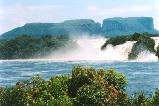
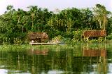
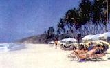
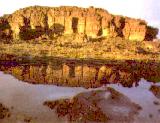
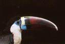
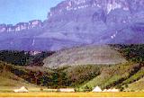


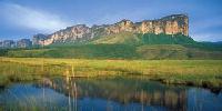
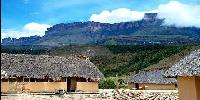
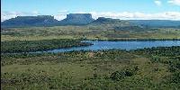
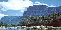
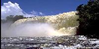
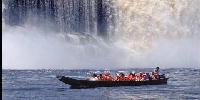
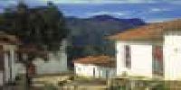
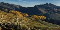
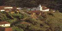
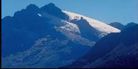
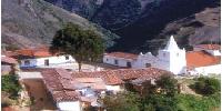
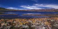
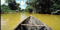
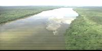
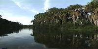
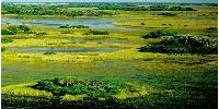
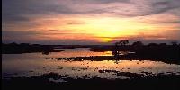
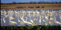
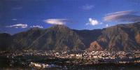
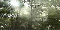
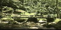

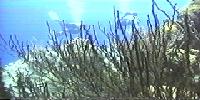
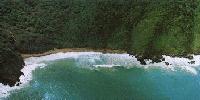
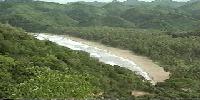
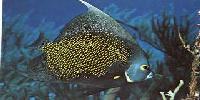
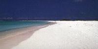

